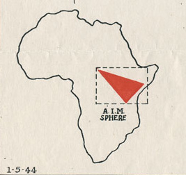
Maps are a common feature of archival collections, and the Wheaton College Billy Graham Center Archives is no exception. The Archives’ oversize storage cases contain a wide variety of maps—thematic, navigational, topographical, and even blueprints—used for diverse range of research topics and as a popular tool in archival instruction sessions. As primary sources, maps require a specific set of skills to “read” and interpret. Like all items held in the Archives, maps are social documents, reflecting both the intentions and abilities of their creators (cartographers) as well as the needs and expectations of their anticipated users. Maps tell stories. While a single map can capture a landscape, metropolitan grid, or continent frozen in time, a series of maps can document gradual or abrupt change, like shifting national or regional boundaries, erosion of natural landmarks, or rapid urbanization. No map, however extensive or detailed, can be entirely authoritative. They are not neutral documents—maps reveal the political and cultural perspectives and biases of their creators. They can erase as well as document borders, languages, people groups, or landmarks. Finally, maps are frequently described in purely functional terms, providing information and direction to users, but in many cases they are also highly ornamental, utilizing artistic techniques to feature specific geographical or topographical features.
Continue reading